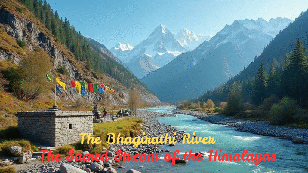
The Bhagirathi River is one of the main rivers that form the mighty Ganges, which is considered sacred by millions in India. It originates from the Gangotri Glacier in the Himalayas, near Gaumukh in Uttarakhand and flows about 3,892 meters (12,769 feet). The river is named after King Bhagirath, a legendary figure in Hindu mythology who is believed to have brought the Ganga down from heaven to cleanse the sins of his ancestors.
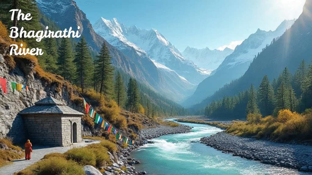
The Bhagirathi flows through the beautiful and spiritual landscape of Uttarakhand, passing through towns like Gangotri, Uttarkashi, and Tehri. Along its path, it is fed by several smaller streams and rivers, adding to its strength. The river meets the Alaknanda River at Devprayag, and from that point it is known as the Ganga.
The Ganga River basin is one of the largest river basins in the world. Within it, the Bhagirathi basin holds special importance, as it is home to the Gangotri Glacier — the source of the sacred Ganga River. This study focuses on how the changing climate is affecting the snow cover and hydrological patterns within the Bhagirathi basin, highlighting shifts in water flow and seasonal dynamics due to rising temperatures and other environmental changes.
In the journal of ” Statistical analysis of precipitation, temperature and snow cover in Bhagirathi river basin” of “MAUSAM” it has been published that presents the changing climate impact on dynamics of snow cover and hydrological regime of the Bhagirathi basin. The remote sensing satellite data from MODIS, TRMM and Cartosat DEM are used and watershed delineation, snow cover area extraction, trend and correlation analysis are performed in ArcGIS and R statistical software respectively. The results of trend analysis show a negative and weak association in precipitation data and positive but weak association in temperature data. However, when correlation analysis was done for different stations in the basin a strong positive correlation was found among the precipitation and temperature data for Kendall (0.93), Spearman (0.99) and Pearson (0.99) methods. A weak correlation was found between inflow and percentage snow cover area in the Bhagirathi basin for Kendall (0.04), Spearman (0.06) and Pearson (0.07) methods. The study findings present an insight into the precipitation, temperature and snow cover area data statistically. Further a better understanding of the data can be established if sub-basin level study is performed.
Apart from its religious significance, the Bhagirathi River is also vital for the region’s ecology and economy. It supports local agriculture, provides drinking water, and is used for generating hydroelectric power at projects like the Tehri Dam.
With its pure glacial origins, cultural importance, and breathtaking surroundings, the Bhagirathi River is not just a river – it’s a lifeline and a symbol of devotion and purity for millions of Indians.
What is the Bhagirathi River?
The Bhagirathi River is a Himalayan river of Uttarakhand state in India. It has two main headstreams of River Ganga and Alaknanda River.
Where does the Bhagirathi River originate?
The Bhagirathi originates from the Gangotri Glacier near Gaumukh, at an altitude of about 3,892 meters in Uttarkashi district of Uttarakhand.
Why is the Bhagirathi River important?
Bhagirathi River is important for both geographically and religiously. It is considered the source stream of the Ganga River and is closely tied to Hindu mythology and rituals. It also plays a vital role for water supply and hydropower generation.
What are the major tributaries of the Bhagirathi River?
Some major tributaries include the Kedar Ganga, Jadh Ganga, Kakora Gad, Jalandhari Gad, and Bhilangna River.
What is the role of the Tehri Dam on the Bhagirathi River?
The Tehri Dam is built on the Bhagirathi River near Tehri town. It is one of India’s largest hydroelectric projects for power generation, irrigation, and flood control.
What is the length of the Bhagirathi River?
The Bhagirathi River is approximately 205 kilometers long from its origin at Gaumukh to its confluence with the Alaknanda at Devprayag.
What does Bhagirathi River Logo stands for ?
The Bhagirathi River Logo Usually Stands For:
1. Purity and Origin of the Ganga:
Since the Bhagirathi is the source stream of the Ganga, the logo often represents spiritual purity, sacredness, and divine origin.
2. Himalayan Heritage:
The river’s glacier-fed source in the Gangotri Glacier and its flow through the Himalayas are usually symbolized with snow-capped peaks or flowing water.
3. Spiritual Significance:
The name ‘Bhagirathi’ is linked to King Bhagirath, a key figure in Hindu mythology. A symbolic or artistic representation of him may be included in some variations.
4. Nature and Conservation:
Logos designed by environmental or river conservation groups may include green leaves, flowing water, or eco-symbols to highlight the river’s ecological importance and the need to protect it.
5. Cultural and Religious Identity:
Since the river is sacred to Hindus, symbols like lotus flowers, temples, or traditional Indian patterns may be used to reflect its cultural value.
Why the Bhagirathi River Looks Green ?
The Bhagirathi River appears green due to a mix of glacial minerals, clear water, sunlight, and reflections from nature. It shows that the river is very clean and natural, especially in the upper parts of the Himalayas.