Uttarkashi, a spiritual mountain town nestled in Uttarakhand’s Garhwal region. This place is perfect for travelers seeking natural beauty, religious sites, and adventure activities in the Himalayas. This guide explores Uttarkashi’s geography along the sacred Bhagirathi River, highlights significant historical events that shaped the region, and showcases the best temples, trekking spots, and natural attractions for visitors.
Geographic Overview of Uttarkashi

Location and Elevation in Uttarakhand
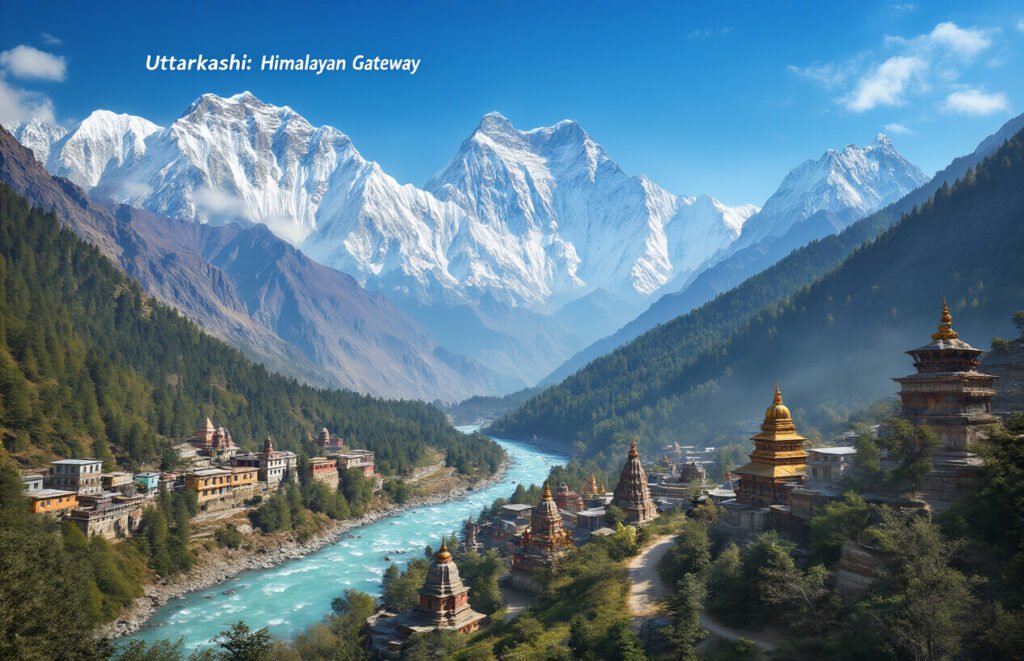
Uttarkashi is located at 30°44′N 78°27′E in the upper Himalayas of Uttarakhand, India. With an average elevation of 1,158-1,165 meters (3,799-3,822 ft), this mountainous district serves as the headquarters for Uttarkashi district. The town lies in a region characterized by varying geographic environments, from snow-free valleys to high peaks with perpetual snow and glaciers.
Topographical Features
The terrain of Uttarkashi consists primarily of high-rise ridges, hills, and plateaus with flat land being scarce. The landscape features series of ridges and valleys that coil into seemingly unending chains. Most of the land has reduced fertility due to large content of boulders and gravels, except in the valleys which contain alluvial soil. Approximately 88% of the district’s total area is administered by the Forest Department, showcasing its predominantly mountainous character.
Rivers and Natural Landscapes
Uttarkashi is the birthplace of two of India’s most revered rivers – The Bhagirathi and the Yamuna. The Ganga originates from the Gaumukh glacier and traverses 128 kilometers within Uttarkashi district before flowing downstream. The Tons River is the third major waterway, complemented by numerous tributaries that drain the region. The district features breathtaking natural variations from beautiful landscapes with lush vegetation to awesome rocky ridges and snow-capped peaks.
Population Statistics and Literacy Race and Education
According to the 2001 India census, Uttarkashi city had a population of 40,220, with males constituting 57% and females 43% of the residents. The town boasts an average literacy rate of 78%, significantly higher than the national average of 59.5%. Male literacy stands at 83%, while female literacy is at 71%. Children under 6 years of age make up 11% of the population. By 2019, the district population had grown to 329,686.
Major Events and Incidents

2023 Uttarkashi Tunnel Rescue
The Silkyara Bend-Barkot tunnel collapse on November 12, 2023, trapped 41 construction workers for 16 days. The incident occurred during construction of the Char Dham project tunnel in Uttarkashi district. Multiple agencies participated in the rescue operation, including NDRF, SDRF, Indian Army engineers, and the Border Roads Organisation. After several setbacks with mechanical drilling, “rat-hole” miners manually broke through the remaining debris on November 28, successfully rescuing all trapped workers.
1991 Uttarkashi Earthquake
The 1991 Uttarkashi earthquake was a significant seismic event that affected the region, causing substantial damage to infrastructure and resulting in casualties. The earthquake highlighted the geological vulnerability of the area, which sits near the main central thrust of the Himalayas—a major geological fault zone. This event prompted improvements in disaster preparedness and building codes throughout the region.
2025 Uttarakhand Flash Flood
The Uttarakhand flash flood of 2025 struck on 5 August in Uttarkashi, Uttarakhand, India. The disaster claimed at least five lives and left over 50 people missing.
What are the Cause of Uttarakhand Flash Flood ?
The exact cause of the 2025 Uttarakhand flash flood is still under investigation. While early media reports pointed to a cloudburst as the likely trigger, scientists are now considering other possibilities, including a glacial lake outburst flood (GLOF), a glacier collapse, a landslide, or a combination of these natural events. These factors may have led to the sudden and forceful overflow of the Kheer Ganga river. The floodwaters, laden with debris and mud, swept through Dharali village and nearby areas, causing widespread destruction. Prior to the incident, the India Meteorological Department (IMD) had issued a warning for heavy rainfall in the region, effective until 10 August.
Tourism and Visitor Attractions

Mountain Trails, Forest and Adventure Opportunities
Uttarkashi offers exceptional trekking experiences with destinations like Dayara Bugyal, an extensive alpine meadow located 28 km from town. The region also features Har Ki Doon valley, situated about 140 kilometers away, where visitors can enjoy spectacular views of snow-capped peaks and alpine flowers. Dodital, a freshwater lake 30 kilometers from Uttarkashi, provides both spiritual significance and opportunities to explore diverse flora and fauna.
Religious and Cultural Sites
The area boasts numerous sacred destinations including Gangotri Temple, approximately 100 kilometers from Uttarkashi and part of the revered Char Dham Yatra. Yamunotri Temple, located 140 kilometers away, honors Goddess Yamuna. Other significant sites include Gangnani with its natural hot springs, Bhairav Temple at Bhairav Ghati, and Nachiketa Tal, a high-altitude lake known for its spiritual importance in Hindu tradition.

Conclusion:
Uttarkashi stands as a remarkable destination that beautifully blends natural splendor with cultural significance. From its breathtaking Himalayan landscapes and the sacred Ganges flowing through its valleys to its rich history of notable events and resilient responses to natural challenges, this region embodies the spirit of northern India. The district’s renowned temples, adventure sports opportunities, and pristine natural attractions continue to draw visitors seeking both spiritual fulfillment and outdoor excitement.
Whether you’re planning to worship at the ancient Vishwanath Temple, challenge yourself on the trekking trails to Gaumukh, or simply absorb the tranquil mountain atmosphere, Uttarkashi offers experiences that resonate with the soul. As tourism evolves in this region, responsible travel practices will help preserve its natural beauty and cultural heritage for generations to come. Consider adding this Himalayan gem to your travel bucket list—Uttarkashi awaits with open arms and unforgettable experiences.